Gilmore Summit Webcam on SH-28 Near Leadore, Idaho
Gilmore Summit Webcam on SH-28 Near Leadore, Idaho (MP 73.1, Elevation 7,018 Feet)
The Gilmore Summit Webcam provides a live view of traffic, weather, visibility, and road conditions along Idaho State Highway 28 near Gilmore Summit. Located at milepost 73.1 and an elevation of 7,018 feet, the camera helps travelers monitor conditions at one of the highest highway crossings in eastern Idaho.
State Highway 28 is an important rural highway connecting Salmon, Leadore, and Interstate 15 near Dubois. The route travels through broad mountain valleys, ranchlands, and remote landscapes beneath the towering peaks of the Beaverhead Mountains and Lemhi Range.
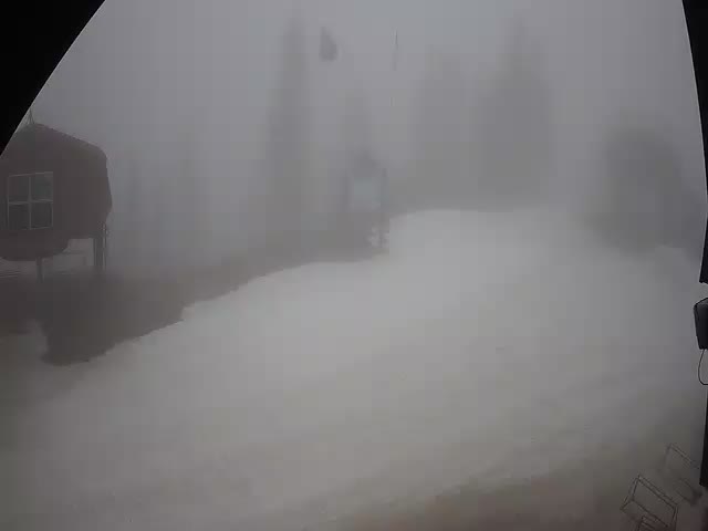
The webcam offers a real-time look at traffic flow, roadway conditions, visibility, and weather. Travelers frequently use the camera to monitor snow, ice, wind, fog, and changing mountain weather before crossing the summit. Winter storms can create difficult travel conditions at this elevation, while spring and fall often bring rapidly changing weather patterns.
Gilmore Summit sits near the historic mining community of Gilmore, once one of Idaho’s most productive mining districts. Today, the area is known for its wide-open scenery, mountain views, wildlife habitat, and quiet backcountry character.
Whether you’re traveling between Salmon and Dubois, exploring eastern Idaho, or checking road conditions before crossing the summit, the Gilmore Summit Webcam provides valuable real-time information that helps improve travel planning and roadway safety.
About Gilmore Summit and SH-28
Gilmore Summit is one of the highest points along State Highway 28 and serves as an important mountain crossing between the Lemhi Valley and the upper Snake River Plain. At more than 7,000 feet in elevation, the summit experiences long winters and significant seasonal weather changes.
The nearby ghost town of Gilmore was once a thriving mining community that supported lead, silver, and copper operations in the surrounding mountains. While little remains today, the area’s history remains an important part of Idaho’s mining heritage.
State Highway 28 provides a scenic alternative to Interstate 15 and is widely used by ranchers, recreation travelers, truck traffic, and visitors exploring eastern Idaho. The highway passes through some of the state’s most open and dramatic landscapes.
The region is home to elk, mule deer, pronghorn, moose, and other wildlife. Outdoor recreation opportunities include hunting, hiking, camping, wildlife viewing, and scenic driving.
The Gilmore Summit Webcam provides travelers with a valuable real-time look at weather and roadway conditions while showcasing one of Idaho’s highest highway summits.
Idaho Highway Webcams
Idaho Interstate Webcams
US Highway Webcams
Idaho State Highway Webcams
Webcam Sponsor – Idaho DOT
Why Travelers Use the Gilmore Summit Webcam
• Check traffic conditions on SH-28
• Monitor weather and visibility at Gilmore Summit
• View roadway conditions before crossing the summit
• Check winter snow and ice conditions
• Monitor mountain weather in real time
• Plan trips between Salmon, Leadore, and Dubois
• Check visibility during storms and high winds
• Improve travel safety with live roadway information
Where is the Gilmore Summit Webcam located?
The webcam is located on SH-28 at milepost 73.1 near Gilmore Summit in eastern Idaho.
Can I check road conditions with this webcam?
Yes. The camera provides a live view of traffic flow, roadway conditions, visibility, and weather along SH-28.
Does the webcam show weather conditions?
Yes. Travelers can monitor snow, rain, fog, cloud cover, wind, and visibility in real time.
What weather location should I use?
Use Leadore, Idaho for weather and current conditions associated with the Gilmore Summit Webcam.
More Idaho Webcams