US-285 Webcams in Poncha Springs, Colorado

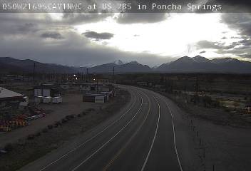
US-285 webcam in Poncha Springs, Colorado 0.3 miles S of US 50 at milepost 126.25: Looking South

US-285 webcain in Poncha Springs, Colorado 0.3 miles S of US 50 at milepost 126.25: Looking North

US-285 webcain in Poncha Springs, Colorado 0.3 miles S of US 50 at milepost 126.25: Looking at Road Surface
US-285 Webcams in Poncha Springs, Colorado
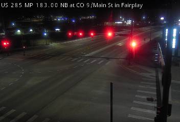
The US-285 webcams in Poncha Springs, Colorado provide real-time views of traffic flow and road conditions along a key mountain junction in central Colorado. This section of US-285 runs through Poncha Springs in Chaffee County and serves as a major route connecting the San Luis Valley with the Arkansas River Valley and the Front Range.
Webcams in the Poncha Springs area are typically located near the intersection of US-285 and US-50, offering views of both northbound and southbound traffic along with turning movements at this busy junction. These cameras help drivers monitor conditions at one of the most important highway connections in the region.
Traffic flow in Poncha Springs is generally moderate but can increase during peak travel periods. This area sees a mix of local traffic, long-distance travelers, and commercial vehicles moving between Salida, Buena Vista, and the San Luis Valley. Congestion is most common near the US-50 intersection.
Road conditions in this area can change quickly due to elevation and surrounding mountain terrain. Winter storms frequently bring snow and icy conditions, while strong winds and blowing snow can reduce visibility. During warmer months, rain and summer thunderstorms may impact driving conditions.
Seasonal travel conditions vary throughout the year. Winter presents the highest risk for hazardous driving, while summer brings increased traffic from tourism and outdoor recreation. The webcams provide a clear, up-to-date look at roadway conditions and weather visibility in Poncha Springs.
Whether traveling north toward Buena Vista and Fairplay or south toward the San Luis Valley, these US-285 webcams in Poncha Springs offer valuable insight into traffic flow, road conditions, and weather visibility to help you plan your trip safely.
US-285 Corridor through Poncha Springs and Chaffee County
US-285 is a major north-south highway in Colorado, and in Poncha Springs, it intersects with US-50 to form a critical transportation hub in central Colorado. This junction connects travelers to multiple regions, including the Arkansas Valley, South Park, and the San Luis Valley.
Poncha Springs, Colorado is located just west of Salida and serves as a gateway to several mountain passes and recreation areas. The highway corridor here is influenced by surrounding mountain ranges and varying elevation.
The corridor features a mix of straight stretches and gentle curves, with traffic that includes local residents, commercial vehicles, and recreational travelers. The intersection with US-50 adds additional turning traffic and increases congestion during peak periods.
Geographically, the area is influenced by mountain weather patterns. Winter storms can bring snow and icy roads, while summer thunderstorms may reduce visibility and create temporary hazards. Elevation changes can also impact driving conditions.
US-285 through Poncha Springs is a vital link connecting central Colorado regions and supporting both daily travel and tourism.
Overall, the US-285 corridor in Poncha Springs is a busy and important route, and webcams in this area provide a valuable tool for monitoring real-time traffic and weather conditions.




Why Use This Webcam
- Check real-time traffic flow on US-285 in Poncha Springs
- Monitor road conditions at the US-50 junction
- View current weather visibility including snow, wind, or storms
- Identify congestion at a major highway intersection
- Plan safer and more efficient travel through central Colorado
Frequently Asked Questions
Where is this webcam located?
These webcams are located along US-285 in Poncha Springs, Colorado, typically near the US-50 intersection in Chaffee County.
Can I check road conditions with this webcam?
Yes, the webcams allow you to view current road conditions including traffic, snow, ice, wind, and visibility.
Does the webcam show weather conditions?
Yes, they provide real-time views of weather conditions such as snowfall, rain, wind, and overall visibility.
Is the webcam live?
Most US-285 webcams update frequently, offering near real-time views of traffic and road conditions.
Colorado Highway Webcams
Colorado Interstate Highway Webcams
US Highway Webcams in Colorado
Colorado State Highway Webcams
More Colorado Webcams