Sequoia National Park Webcam – Giant Forest View
Sequoia National Park Webcam – Giant Forest View
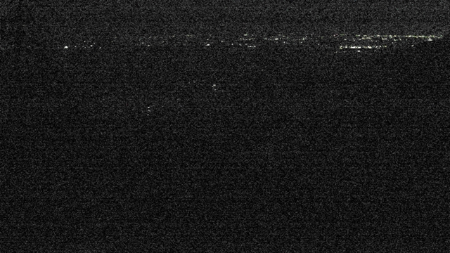
The Sequoia National Park Webcam looks southwest from the edge of Giant Forest across the forested slopes and deep canyons of the western Sierra Nevada. The view descends toward the Kaweah River drainage and the foothills above California’s San Joaquin Valley.
Mixed-conifer forest fills the foreground, with successive mountain ridges fading into the distance. On exceptionally clear days, visitors may be able to see across the San Joaquin Valley toward the Coast Range. Those distant features are frequently hidden by haze, smoke or air pollution.
The webcam is part of the National Park Service air-quality monitoring network. It is designed primarily to document visibility rather than provide a close-up view of giant sequoias. Current still images generally update every 15 minutes, while accompanying weather and air-quality measurements update hourly.
This camera is particularly useful for checking haze, wildfire smoke, cloud cover, snow and general visibility around Giant Forest. Summer images often reveal a gray or brown layer of polluted air over the valley below. During winter, snow may cover the foreground and surrounding slopes even while lower elevations near Three Rivers remain green and relatively warm.
Because elevation changes rapidly in Sequoia National Park, the webcam represents conditions around Giant Forest—not the foothills or the higher Sierra wilderness.
See Current Conditions Below Giant Forest
The camera looks outward from the giant sequoia grove rather than inward at its famous trees. Individual giant sequoias are difficult to identify in the wide view, but the surrounding forest and layered Sierra terrain provide valuable context for where the grove grows.
Giant Forest lies at approximately 6,400 to 7,000 feet on the western slope of the Sierra Nevada. From this middle-elevation zone, the land drops sharply toward the foothills and agricultural valley.
Visibility varies dramatically. Under clear conditions, details emerge on distant ridges and the horizon extends toward the San Joaquin Valley. On polluted or smoky days, the ridges blend into a pale gray layer and the valley may disappear completely.
Clouds and winter storms can also obscure the view without indicating poor air quality. Fog, rain and snow scatter light naturally, so visitors should use the webcam alongside the accompanying air-quality readings.
The image can provide a general preview of snow around Giant Forest, but it cannot confirm road conditions, tire-chain requirements or access to specific attractions.
About Sequoia and Kings Canyon National Parks
Sequoia and Kings Canyon are separate national parks administered together as one unit. They protect giant sequoia groves, deep river canyons, Sierra Nevada peaks and an extensive wilderness stretching toward the crest of the range.
Sequoia National Park includes the Foothills, Giant Forest, Lodgepole and Mineral King areas. Kings Canyon National Park includes Grant Grove and Cedar Grove, along with vast backcountry surrounding the upper Kings River.
Giant Forest is the heart of Sequoia National Park’s most famous landscape. Giant sequoias grow naturally only on the western slope of California’s Sierra Nevada, generally between 4,000 and 8,000 feet. They occur in scattered groves where elevation, soil moisture and climate create suitable conditions.
The General Sherman Tree stands within Giant Forest. Measured by trunk volume, it is the largest known living single-stem tree on Earth. Giant sequoias are not the world’s tallest or oldest trees, but their massive trunks make them the largest by volume. Some individuals can live for more than 3,000 years.
Fire has always played an important role in these forests. Low- and moderate-intensity fires clear competing vegetation and expose mineral soil where sequoia seeds can germinate. However, recent drought, hotter conditions and heavy fuel accumulation have contributed to unusually severe wildfires capable of killing mature giant sequoias.
The webcam’s outward view also illustrates the parks’ enormous elevation range. The landscape rises from approximately 1,370 feet along the Middle Fork of the Kaweah River to more than 14,000 feet at Mount Whitney on the eastern boundary. Weather, plants and road conditions can change completely over relatively short driving distances.
Mount Whitney is not visible from the webcam. The camera points west toward the foothills and valley, while the Great Western Divide blocks road-based views of Mount Whitney from inside the parks.
See California Park Webcams





Why the Air Can Look Hazy Below Giant Forest
Sequoia and Kings Canyon experience some of the most persistent air-quality challenges in the national park system. Their position above the San Joaquin Valley places them downwind of a large agricultural and urban region.
Air circulation within the valley can trap pollution and carry it eastward into the Sierra Nevada. During warm, sunny weather, pollutants can contribute to ground-level ozone. Fine particles from vehicles, industry, agriculture and wildfire smoke reduce visibility and create the pale layer often seen on the webcam.
The effects extend beyond the view. Ground-level ozone can irritate human lungs and damage sensitive plants, including ponderosa and Jeffrey pines. Fine-particle pollution can create health risks, particularly for children, older adults and people with heart or respiratory conditions.
Wildfire smoke creates a separate but overlapping problem. A smoky webcam image does not reveal whether the fire is nearby or hundreds of miles away. Wind can transport smoke across California and into the parks from distant incidents.
The clearest views frequently occur after a storm or a change in weather clears the atmosphere. On those days, ridges that normally dissolve into haze become sharply defined, and the San Joaquin Valley or distant Coast Range may emerge.
Exploring Giant Forest
The General Sherman Tree is Giant Forest’s best-known attraction, but it is only one part of the grove. Trails connect enormous sequoias, meadows and mixed-conifer forest throughout the area.
The paved General Sherman Tree Trail descends approximately half a mile from the main parking area. Visitors should remember that the return walk is uphill at close to 7,000 feet in elevation.
Nearby Moro Rock provides a completely different perspective. More than 350 concrete and stone steps climb the granite dome, opening views toward the foothills and San Joaquin Valley in one direction and the Great Western Divide in the other.
Crescent Meadow offers a gentler landscape of meadow, forest and giant sequoias. The area also provides access to Tharp’s Log and longer trails into the surrounding wilderness.
Planning a Visit to Sequoia and Kings Canyon
Three Rivers is the principal gateway to Sequoia National Park’s Foothills and Giant Forest areas. Generals Highway climbs steeply from the park entrance through numerous switchbacks before reaching the sequoia groves.
The road is narrow and winding, and vehicle-length advisories apply to some sections. There are no gas stations inside the parks, so visitors should arrive with adequate fuel.
Summer provides the easiest access to most developed areas, but parking can be difficult around Giant Forest. Park shuttles operate during the primary visitor season and are often the easiest way to reach the General Sherman Tree, Moro Rock and Crescent Meadow.
Winter transforms Giant Forest into a snowy environment. Tire chains may be required even when roads are open, and storms can temporarily close portions of Generals Highway. Cedar Grove and Mineral King are generally seasonal destinations.
Temperatures near Three Rivers provide a poor indication of conditions at Giant Forest. The grove sits roughly a mile higher in elevation, so always check the forecast and road report for the specific park area.
Why Use the Giant Forest Webcam?
- Check visibility across the western Sierra foothills.
- Look for haze over the San Joaquin Valley.
- Monitor the visible effects of wildfire smoke.
- See whether snow is present around Giant Forest.
- Watch clouds and storms move across the mountains.
- Compare clear days with heavily polluted conditions.
- Preview general weather near the sequoia grove.
- Observe seasonal changes in the surrounding forest.
Sequoia National Park Webcam FAQs
Where is the Giant Forest webcam located?
The camera is positioned near the western edge of Giant Forest in Sequoia National Park, California.
What does the webcam show?
It looks southwest across forested Sierra Nevada slopes and the lower Kaweah River drainage toward the foothills and San Joaquin Valley.
Can I see the General Sherman Tree?
No. The camera looks outward from Giant Forest and does not provide a close-up view of the General Sherman Tree or other named sequoias.
Can I see Mount Whitney?
No. Mount Whitney lies on the eastern boundary of Sequoia National Park. The webcam faces west or southwest, and the Great Western Divide blocks Mount Whitney from developed park roads.
Is this a live-streaming webcam?
No. The camera displays current still images that normally update approximately every 15 minutes.
Why does the view often look hazy?
Pollution can become trapped in the San Joaquin Valley and move into the Sierra Nevada. Fine particles, ground-level ozone and wildfire smoke can all contribute to reduced visibility.
Can the webcam confirm whether Generals Highway is open?
No. It can show broad weather and snow conditions, but it cannot confirm road closures, chain requirements or access to individual attractions.
Does Giant Forest receive snow?
Yes. Giant Forest sits at approximately 6,400 to 7,000 feet and regularly receives winter snow. Conditions can be dramatically colder and snowier than in Three Rivers.
What is the best time to watch the webcam?
Morning often provides better visibility before summer haze intensifies. The clearest long-distance views frequently follow storms or weather changes that remove pollution and airborne particles.
For more live views from the region, explore our California Webcams, California Mountain Webcams, Sierra Nevada Webcams and National Park Webcams.
More California Webcams