Padre Island Webcam
Padre Island National Seashore Webcam – Malaquite Beach
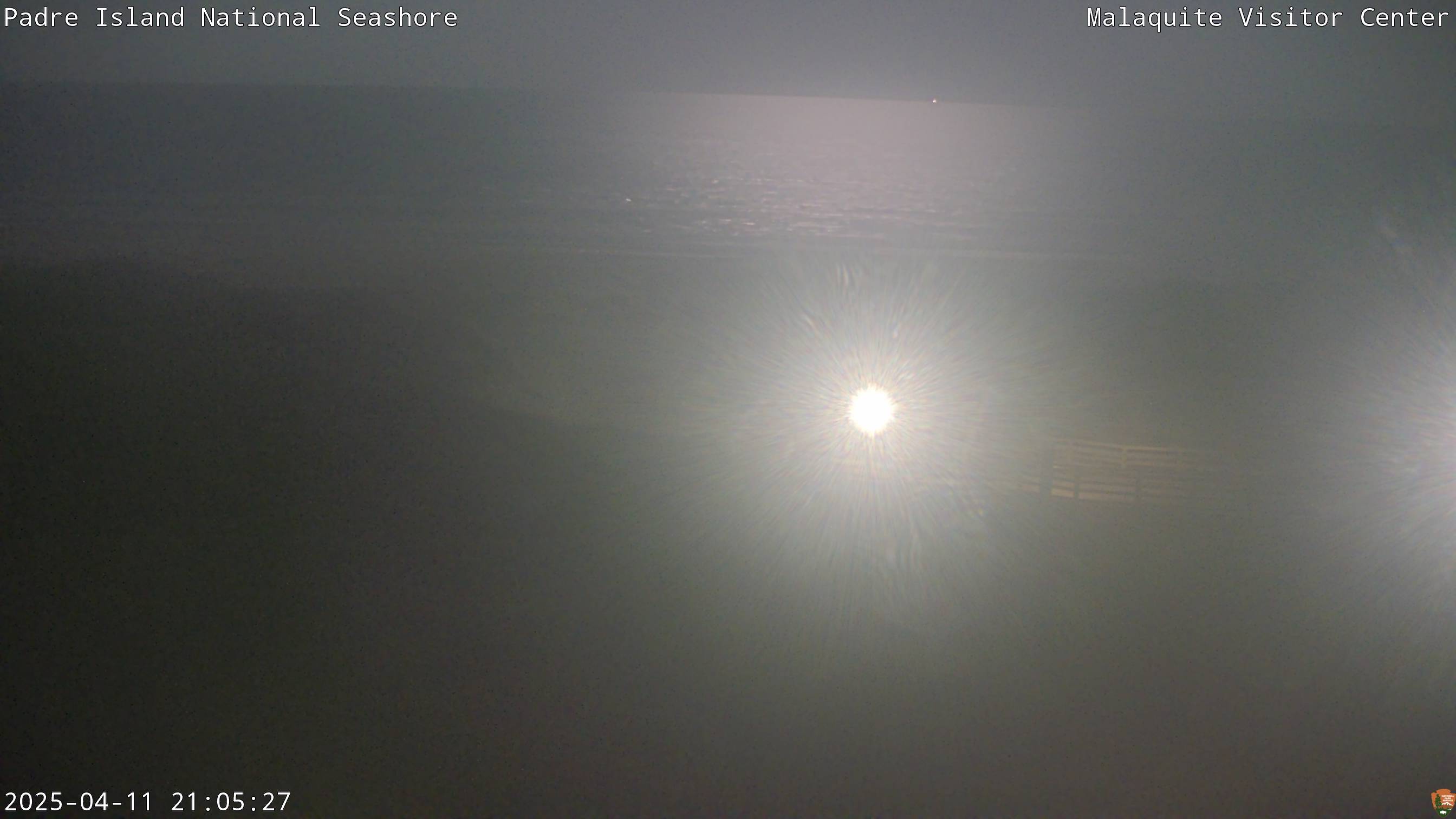
The Padre Island National Seashore Webcam overlooks Malaquite Beach from the Malaquite Visitor Center near Corpus Christi, Texas. The camera faces across vegetated coastal dunes and a wide stretch of sand toward the Gulf.
The visitor-center boardwalk appears in the foreground, providing a useful reference for beach access and visible ground conditions. Beyond it, the webcam shows the open beach, surf zone and Gulf horizon. The broad view makes this camera particularly useful for checking cloud cover, visibility, wave activity and the general appearance of Malaquite Beach.
Lines of breaking waves can provide a rough indication of surf conditions. Whitecaps farther offshore may suggest stronger wind, while water pushed high onto the beach can signal elevated tides or rough conditions. The webcam cannot show rip currents or establish whether swimming is safe, however. Visitors should always check the official surf forecast, rip-current risk and tide information before entering the water.
The image also captures the island’s seasonal changes. Dune vegetation may become green after periods of rain and turn brown during dry conditions. Tropical weather can dramatically alter the width and appearance of the beach, while winter cold fronts often bring gray skies, wind and rough surf.
This is a current still-image webcam rather than continuous streaming video. The image normally refreshes about once per minute and includes a visible date and time stamp.
Watch Malaquite Beach and Gulf Conditions
Malaquite Beach is one of the easiest Gulf beaches to reach within Padre Island National Seashore. Unlike the park’s vehicle-access beaches, this area is approached from the visitor center by a boardwalk crossing the dunes.
Because the camera includes the dunes, beach, surf and horizon, it provides a fuller picture than a camera aimed only at the water. Visitors can see whether blowing sand, haze, rain or heavy clouds are affecting the beach.
During sea turtle release events, groups may sometimes be visible gathering on the beach below the visitor center. Individual hatchlings are too small to identify through the webcam, and scheduled public releases are dependent on nest conditions and other factors.
About Padre Island National Seashore
Padre Island National Seashore protects approximately 66 miles of undeveloped barrier-island coastline along South Texas. It preserves the longest stretch of undeveloped barrier-island beach in the United States and covers roughly 130,000 acres of beaches, dunes, grasslands, tidal flats and shallow water.
The island separates Gulf waters from the Laguna Madre, a long, shallow lagoon extending along the Texas coast. High evaporation and limited exchange with the Gulf make much of the Laguna Madre hypersaline—saltier than ordinary seawater. Its extensive seagrass beds provide important habitat for fish, birds and other wildlife.
Padre Island’s barrier-island landscape is never completely fixed. Waves, tides, wind and major storms continually move sand and reshape the beach and dunes. Dune vegetation helps trap blowing sand and stabilize parts of the island. Driving or walking over protected vegetation can damage this natural defense against storms and erosion.
The national seashore is internationally significant for migratory birds. Its position along the Central Flyway and mixture of Gulf, lagoon, wetland and grassland habitats attract an extraordinary variety of species. Brown pelicans, reddish egrets, terns, plovers, crested caracaras and many other birds may be seen during the year.
Padre Island is also the most important nesting beach in the United States for the endangered Kemp’s ridley sea turtle. All five threatened or endangered sea turtle species found in the Gulf region have been documented within the park and its surrounding waters.
Malaquite Beach lies near the northern end of the national seashore. Its visitor center, observation deck, boardwalk and nearby campground make it a practical introduction to the park before visitors continue into its more remote areas.
See Texas Parks Webcams


Sea Turtles of Padre Island
Five species of sea turtle use Padre Island or the surrounding waters: Kemp’s ridley, green, loggerhead, leatherback and hawksbill turtles. Kemp’s ridleys receive particular attention because more of them nest at Padre Island National Seashore than anywhere else in the United States.
The park’s Sea Turtle Science and Recovery program locates and protects nests, studies turtle movements and habitat use, and responds to stranded animals. When appropriate, eggs from vulnerable Kemp’s ridley nests are incubated under protected conditions.
Public hatchling releases generally occur during the summer nesting season, often on Malaquite Beach in front of the visitor center. Release dates cannot be accurately predicted far in advance because the hatchlings must be ready to emerge. A planned release can also be changed or canceled due to weather, tides or other conditions.
The webcam may show people assembling on the beach during a release, but viewers should not expect to see individual hatchlings. The turtles are only a few inches long and travel from the release area toward the water.
Planning a Visit to Padre Island National Seashore
The Malaquite Visitor Center is approximately 30 miles southeast of central Corpus Christi. A paved road reaches the visitor center, campground and northern developed areas of the national seashore.
South Beach continues for approximately 60 miles beyond the end of the paved road. The beach becomes the driving route. Four-wheel drive is strongly recommended, and two-wheel-drive vehicles are permitted only on North Beach and the first five miles of South Beach. Sand, tides and debris can change driving conditions quickly. The park does not tow private vehicles, and commercial recovery from remote portions of the beach can be extremely expensive.
Spring and fall can provide pleasant beach weather, although wind is common. Summers are hot and humid, and the Atlantic hurricane season extends from June through November. Winter is generally mild but may include strong cold fronts and rough surf.
Visitors should check tides, rip-current risk, weather and beach-driving conditions before arriving. The webcam is a useful visual check, but it cannot reveal every water or road hazard.
Why Use the Malaquite Beach Webcam?
- Check the current appearance of Malaquite Beach.
- See wave activity and visible whitecaps.
- Observe cloud cover and visibility over the Gulf.
- Look for blowing sand or rain near the visitor center.
- See how far water appears to be reaching up the beach.
- Watch seasonal changes in coastal dune vegetation.
- Preview conditions before driving from Corpus Christi.
- Look for gatherings associated with special beach programs.
Padre Island National Seashore Webcam FAQs
Where is the Padre Island webcam located?
The camera is mounted near the Malaquite Visitor Center within Padre Island National Seashore, southeast of Corpus Christi.
What does the webcam show?
The view includes vegetated dunes, the visitor-center beach boardwalk, Malaquite Beach, breaking waves and the Gulf horizon.
Is the webcam live?
It provides an updated still image rather than continuous streaming video. The image normally refreshes about once per minute.
Can the webcam show whether swimming is safe?
No. Wave appearance can provide general context, but the camera cannot reliably show rip currents, water quality or every dangerous condition. Visitors should check official beach and surf information.
Can I see sea turtles on the webcam?
Individual sea turtles and hatchlings are generally too small to identify. Groups attending a public hatchling release may occasionally be visible on the beach.
When are sea turtle hatchling releases held?
Public releases typically occur from mid-June through August, but dates depend on when hatchlings are ready. Announcements may be made with limited notice, and releases can change because of weather or nest conditions.
Can visitors drive on Malaquite Beach?
Malaquite Beach is reached by boardwalk from the visitor center. Vehicle beach access is available on North Beach and South Beach, subject to current conditions and park regulations.
Is four-wheel drive required to travel down Padre Island?
Four-wheel drive is strongly recommended. Two-wheel-drive vehicles are permitted on North Beach and only between Mile 0 and Mile 5 on South Beach. Conditions may still be difficult within those areas.
What is the best time to visit Padre Island National Seashore?
Spring and fall often provide comfortable temperatures. Summer is hot and humid but coincides with sea turtle nesting and hatchling-release season. Winter is generally mild, although strong cold fronts can affect beach conditions.
More Texas Webcams
See More of Texas!
For more live views from the region, explore our Texas Webcams, Texas Lake Webcams, and National Park Webcams.