Hurricane Ridge Webcams – Olympic National Park

Webcam view of Hurricane Ridge Parking lot in Olympic National Park
Hurricane Ridge Webcams – Olympic National Park
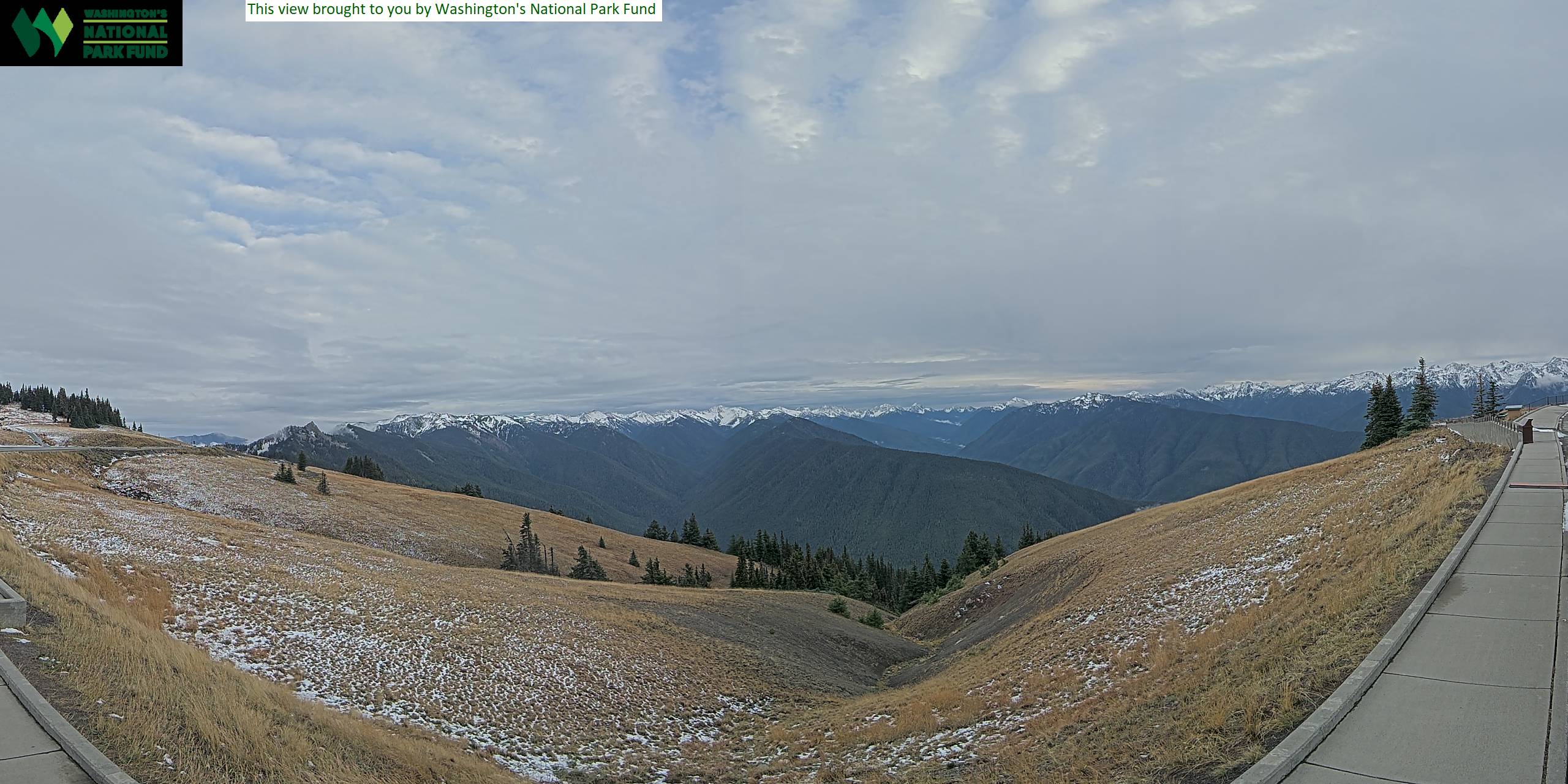
The Hurricane Ridge webcams show two sides of this popular mountain destination in Olympic National Park. The first camera provides the scenic view, looking south across the ridge toward the Lillian and Elwha River valleys. On a clear day, the view opens into the rugged interior of the Olympic Mountains. Clouds, fog and falling snow can completely hide those distant ridges within minutes.
The second camera overlooks the Hurricane Ridge parking area from the north side of the Visitor Contact Station. Its view is less dramatic, but often more useful for evaluating immediate conditions. It can reveal rain, fog, accumulated snow, pavement conditions, visibility and activity around the parking area.
Together, the cameras provide a helpful preview of conditions at approximately 5,242 feet above sea level. Weather at Hurricane Ridge can be very different from conditions in Port Angeles, only 17 miles away by road. Both cameras display regularly updated still images rather than continuous streaming video.
Hurricane Ridge Webcam – Olympic Mountain View
The primary Hurricane Ridge webcam faces south across open subalpine terrain toward the Lillian and Elwha River valleys. Forested slopes descend below the camera, while ridges and peaks of the Olympic interior fill the distance when visibility is good.
This is the better camera for watching the landscape change through the seasons. Deep snow commonly covers the ridge during winter. As the snow retreats, green subalpine meadows emerge and wildflowers appear during the short mountain summer. By late summer and early fall, the grasses often turn shades of gold and brown before the next snow arrives.
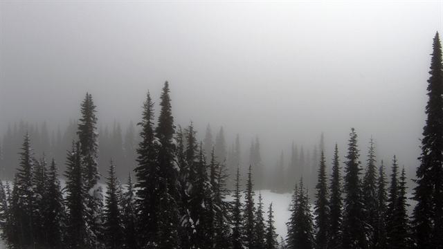
The view also demonstrates how rapidly mountain weather can change. A clear panorama can disappear behind low clouds, fog or precipitation. Water droplets, snow and ice may occasionally obscure part of the camera lens. Those imperfect images still provide useful information: if the valleys and mountains have vanished, visitors should expect limited visibility at the ridge.
Hurricane Ridge Parking Lot Webcam
The second webcam looks across the parking area beside the Hurricane Ridge Visitor Contact Station. It shows the pavement, nearby meadow, tree line and the beginning of the surrounding mountain landscape.
This camera is useful for checking whether snow covers the parking area, whether fog has reduced visibility and how busy the immediate area appears. In winter, it can provide a general look at snowpack around the lot. During warmer months, the number of vehicles offers some indication of activity, although the image cannot confirm whether parking spaces remain available.
The camera only shows conditions at the top. It does not reveal the full condition of Hurricane Ridge Road, which climbs through shaded curves and steep mountain terrain. Ice, drifting snow, fallen rocks or other hazards may affect the road even when the parking-area image looks clear. Always check the official road status before driving to Hurricane Ridge.
About Hurricane Ridge
Hurricane Ridge is Olympic National Park’s most accessible high-elevation destination. The road begins near Port Angeles and climbs from low-elevation forest to an open ridge at approximately 5,242 feet. That rapid rise explains why the webcam may show snow or dense fog while conditions near the coast are mild.
The ridge offers broad views into the Olympic Mountains, a rugged range separated from the Cascade Range by Puget Sound and the surrounding lowlands. Much of the mountainous interior is protected wilderness. Glaciers, steep river valleys and remote peaks occupy country that cannot be reached by road, making Hurricane Ridge one of the easiest places to see into the park’s alpine landscape.
Open meadows surround the developed area. Wildflowers bloom during the short summer growing season, while black-tailed deer, Olympic marmots and Canada jays may be seen nearby. Visitors should remain on designated trails, give wildlife space and never feed animals. The meadows are particularly vulnerable to damage because plants at this elevation have a limited growing season.
Hurricane Ridge is only one part of an unusually varied national park. Olympic also protects temperate rain forests, glacially carved lakes, major river valleys and more than 70 miles of wild Pacific coastline. The Hurricane Ridge cameras capture the mountainous portion of that larger landscape.
The Hurricane Ridge Day Lodge, formerly used as the area’s visitor center, was destroyed by fire in May 2023. The National Park Service now operates a Visitor Contact Station with limited facilities near the parking area. Visitors should not assume that the services once available inside the former lodge have returned.
See Washington Park Webcams



Watching the Seasons at Hurricane Ridge
Winter transforms Hurricane Ridge into a deep-snow environment used for snowshoeing, skiing, snowboarding and other winter recreation. Storms can bring heavy snowfall, strong wind and near-whiteout visibility. Winter road access depends on weather, staffing and safe driving conditions, so the webcam should be used alongside the current NPS road report.
Snow may remain on trails well into spring or early summer. As it melts, the webcam view changes from nearly continuous white to a patchwork of snow, brown grass and emerging vegetation. Summer generally provides the best chance of clear mountain views, although clouds and fog remain possible at any time.
Autumn brings cooler weather and golden-brown meadows. Early snowfall can arrive before winter operations begin, creating conditions that differ sharply from those in Port Angeles.
Planning a Visit to Hurricane Ridge
Hurricane Ridge is reached by a winding 17-mile road from Port Angeles. The climb gains several thousand feet, and weather can change considerably between the city and the parking area.
Summer is the primary season for scenic drives, hiking and wildflower viewing. Popular walks range from short meadow and ridgetop trails to longer routes descending toward mountain valleys. Parking can fill during busy periods, particularly on clear summer weekends.
Winter access is more limited and weather-dependent. Vehicles must carry approved tire chains during the designated winter period, including four-wheel-drive vehicles. Road openings may be delayed or canceled because of snow, ice or high winds.
Bring layers in every season. Sunshine, cold wind, rain and fog can occur during the same visit. Check current road conditions separately—the webcams provide a valuable preview, but neither camera shows the entire route.
Why Use the Hurricane Ridge Webcams?
- See the current view toward the Lillian and Elwha River valleys.
- Check whether clouds or fog are hiding the Olympic Mountains.
- Observe snow coverage around the ridge and parking area.
- Compare conditions at Hurricane Ridge with those in Port Angeles.
- Watch the subalpine meadows change through the seasons.
- Get a general sense of activity around the parking area.
- Check for rain or reduced visibility before driving uphill.
- Preview the mountain landscape when planning a park visit.
Hurricane Ridge Webcam FAQs
Where are the Hurricane Ridge webcams located?
Both cameras are at Hurricane Ridge in Olympic National Park, approximately 17 miles south of Port Angeles, Washington.
What does the scenic Hurricane Ridge webcam show?
It looks south across subalpine slopes toward the Lillian and Elwha River valleys. Distant ridges and mountains become visible when the weather is clear.
What does the parking-lot webcam show?
It overlooks the Hurricane Ridge parking area, nearby meadow and tree line from the north side of the Visitor Contact Station.
Are these live-streaming webcams?
No. They display still images that update regularly rather than continuous live video.
Why is the mountain view sometimes completely white or gray?
Clouds and fog frequently move across Hurricane Ridge. Snow, rain, ice or moisture on the camera enclosure may also obstruct part of the image.
Can the webcams confirm that Hurricane Ridge Road is open?
No. The cameras show conditions near the top but cannot reveal hazards along the entire mountain road. Consult the current National Park Service road report before leaving Port Angeles.
Does Hurricane Ridge receive snow?
Yes. Hurricane Ridge is normally snow-covered during winter, and snow can remain on trails into spring or early summer.
Can visitors drive to the webcam location?
Hurricane Ridge is normally reached by road from Port Angeles when the road is open. Access can be restricted by winter weather, road conditions, construction or parking capacity.
For more live views from the region, explore our Washington Webcams, Washington Mountain Webcams and National Park Webcams.
More Washington Webcams
See More Washington State!
Explore more live views across the Evergreen State with our Washington Webcams, Washington Mountain Webcams, Washington Lake Webcams and National Park Webcams.