Haleakalā Crater Webcam – Maui Summit View

Haleakalā Crater Webcam – Haleakalā National Park
The Haleakalā Crater Webcam provides a high-elevation view across the volcanic summit landscape of Haleakalā National Park on Maui. The camera is located at Puʻuʻulaʻula, also known as Red Hill, near the highest point on Haleakalā at 10,023 feet above sea level.
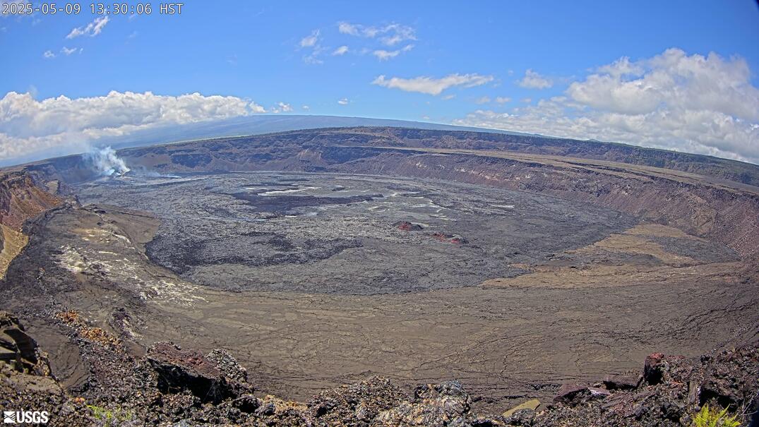
From this position, the camera looks into the enormous summit depression commonly called Haleakalā Crater. Its barren floor, steep walls and colorful volcanic cones create a landscape that can appear more like another planet than a tropical Hawaiian island. On clear days, the camera reveals layers of red, brown, gray and black volcanic terrain beneath an intensely blue sky.
The webcam is particularly useful for checking visibility at the summit. Clouds frequently form below or move across the mountain, and conditions can change rapidly. One image may show an unobstructed view into the crater, while the next may be filled with fog.
Sunrise and sunset bring dramatic changes in color and shadow. During the day, bright sunlight can flatten the landscape, while lower-angle light emphasizes individual cones, ridges and channels. The camera can also capture rain, high winds and occasional ice or snow at the summit.
Maui’s beaches may be warm and sunny while the summit is cold, cloudy and windy. This camera provides a much more relevant look at the conditions visitors will encounter at the top of Haleakalā.
See Current Conditions at Haleakalā Summit
The Haleakalā summit rises above the temperature inversion that commonly traps clouds over Maui. When conditions align, the webcam may show the crater beneath clear sky while a blanket of clouds covers the island’s lower slopes.
Visibility can change within minutes. Clouds flow through gaps in the crater walls, fog forms around the summit and strong winds move weather across the exposed terrain. A completely gray image does not necessarily mean the camera has stopped working—it may simply be inside a cloud.
The view changes subtly through the day. Early light produces long shadows across the crater floor and cinder cones. As the sun rises, the colors become brighter and the differences between individual lava flows and volcanic formations become easier to see. Late-day light returns definition to the ridges before darkness covers the summit.
Although the webcam helps visitors evaluate clouds and visibility, it cannot show temperature or wind speed. Conditions can be surprisingly cold even when the image appears sunny and calm.
About Haleakalā National Park
Haleakalā National Park protects two dramatically different parts of eastern Maui. The Summit District encompasses the upper slopes and volcanic summit of Haleakalā, while the Kīpahulu District descends through tropical vegetation toward the island’s southeastern coast. The two districts are not connected by a road within the park.
Haleakalā is a massive shield volcano that forms more than three-quarters of Maui. Its summit reaches 10,023 feet, making it high enough to experience freezing temperatures and occasional snow despite the island’s tropical location.
The feature commonly called Haleakalā Crater is not a conventional volcanic crater created by one enormous eruption. It is a large erosional depression formed as two valleys cut into the mountain and were later partly filled by younger eruptions. Numerous volcanic cones rise from its floor, preserving evidence of comparatively recent volcanic activity.
These cones account for much of the color visible in the webcam. Different minerals, weathering processes and volcanic deposits create shades of red, orange, brown, gray and black across the otherwise sparsely vegetated landscape.
The summit is also home to rare species adapted to intense sunlight, cold temperatures, limited moisture and volcanic soil. The Haleakalā silversword, or ʻāhinahina, grows only at high elevations on Haleakalā. The nēnē, Hawaii’s native goose, may also be encountered around summit roads and parking areas.
Haleakalā is culturally significant and sacred to Native Hawaiians. Its name is commonly translated as “House of the Sun,” and the summit features prominently in Hawaiian traditions. The webcam offers a view into a place shaped by volcanic activity, erosion, biological isolation and centuries of cultural meaning.
See Hawaiʻi Volcanoes Webcams



Understanding the Haleakalā Crater View
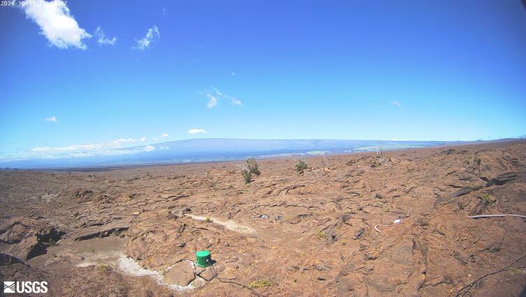
The individual hills rising from the crater floor are volcanic cones formed during eruptions inside the summit depression. These cones are much younger than the main shield volcano and help explain why the landscape contains so many distinct colors and textures.
Broad sections of the crater floor are covered by lava flows, volcanic ash and loose cinders. Vegetation is sparse because the summit is cold, dry and exposed to intense ultraviolet light. The lack of trees and dense plant growth makes the volcanic structure unusually easy to see.
Clouds are another defining part of the view. Moist air moving up the mountain’s slopes cools and condenses, often creating a cloud layer below the summit. At other times, clouds spill into the crater or envelop Puʻuʻulaʻula itself. This movement can transform the view far more quickly than seasonal vegetation changes.
The summit landscape should not be mistaken for lifeless terrain. Rare plants and animals survive here under extremely demanding conditions. Visitors must remain on designated trails to avoid damaging fragile plants and volcanic surfaces.
Planning a Visit to Haleakalā Summit
The Summit District is reached by a long, steep and winding road through Upcountry Maui. No public transportation serves the park, so visitors generally arrive by private vehicle or authorized tour.
Temperatures at the summit can be near freezing even when coastal Maui is warm. Bring warm layers, rain protection and sun protection. Wind can make conditions feel considerably colder than the thermometer suggests.
Advance reservations are required for vehicles entering the Summit District during designated sunrise hours. A sunrise reservation is separate from the park entrance fee. Reservations are not currently required for visiting later in the day or watching sunset, although parking can fill during popular periods.
The rapid change in elevation can affect some visitors. Walk slowly, drink water and avoid strenuous activity if you experience headache, dizziness, nausea or unusual shortness of breath.
The webcam is useful for checking summit visibility before beginning the drive, but conditions may change before you arrive. Always review current park alerts and weather information as well.
Why Use the Haleakalā Crater Webcam?
- Check current visibility across Haleakalā Crater.
- See whether the summit is clear, cloudy or surrounded by fog.
- Watch shadows move across the volcanic cones and crater floor.
- Observe the cloud layer below the summit.
- Preview conditions before driving up from coastal Maui.
- Watch changing light around sunrise and sunset.
- See occasional rain, ice or snow at the summit.
- Experience the volcanic landscape of Haleakalā from anywhere.
Haleakalā Crater Webcam FAQs
Where is the Haleakalā Crater Webcam located?
The camera is located at Puʻuʻulaʻula, or Red Hill, near the 10,023-foot summit of Haleakalā in the Summit District of Haleakalā National Park.
What does the webcam show?
It shows the summit depression commonly called Haleakalā Crater, including its volcanic cones, crater walls and sparsely vegetated volcanic terrain.
Is Haleakalā Crater an actual volcanic crater?
Not in the usual sense. The large depression was primarily created by erosion as valleys cut into the volcano. Later eruptions partially filled it with lava flows and volcanic cones.
Is the webcam live?
The camera displays a current still image rather than continuous streaming video. The NPS webcam page refreshes the image periodically.
Why is the webcam sometimes completely cloudy?
Puʻuʻulaʻula is above 10,000 feet, where clouds and fog can form or move across the summit rapidly. A gray or white image often means the camera is temporarily inside a cloud.
Does it snow at Haleakalā?
Yes. Freezing temperatures, ice and occasional snow are possible at the summit, although snow does not remain throughout the year.
Can the webcam predict sunrise visibility?
It can show current cloud cover, but summit conditions change too quickly to guarantee a clear sunrise. A clear image during the night does not ensure that conditions will remain clear.
Do visitors need a reservation?
Advance reservations are required for vehicles entering the Summit District during sunrise hours. Visitors arriving outside those designated hours do not currently need a sunrise reservation, but normal park entrance requirements still apply.
More Hawai’i Webcams