Big Bend National Park Webcam – Panther Junction

Big Bend National Park Webcam – Panther Junction View
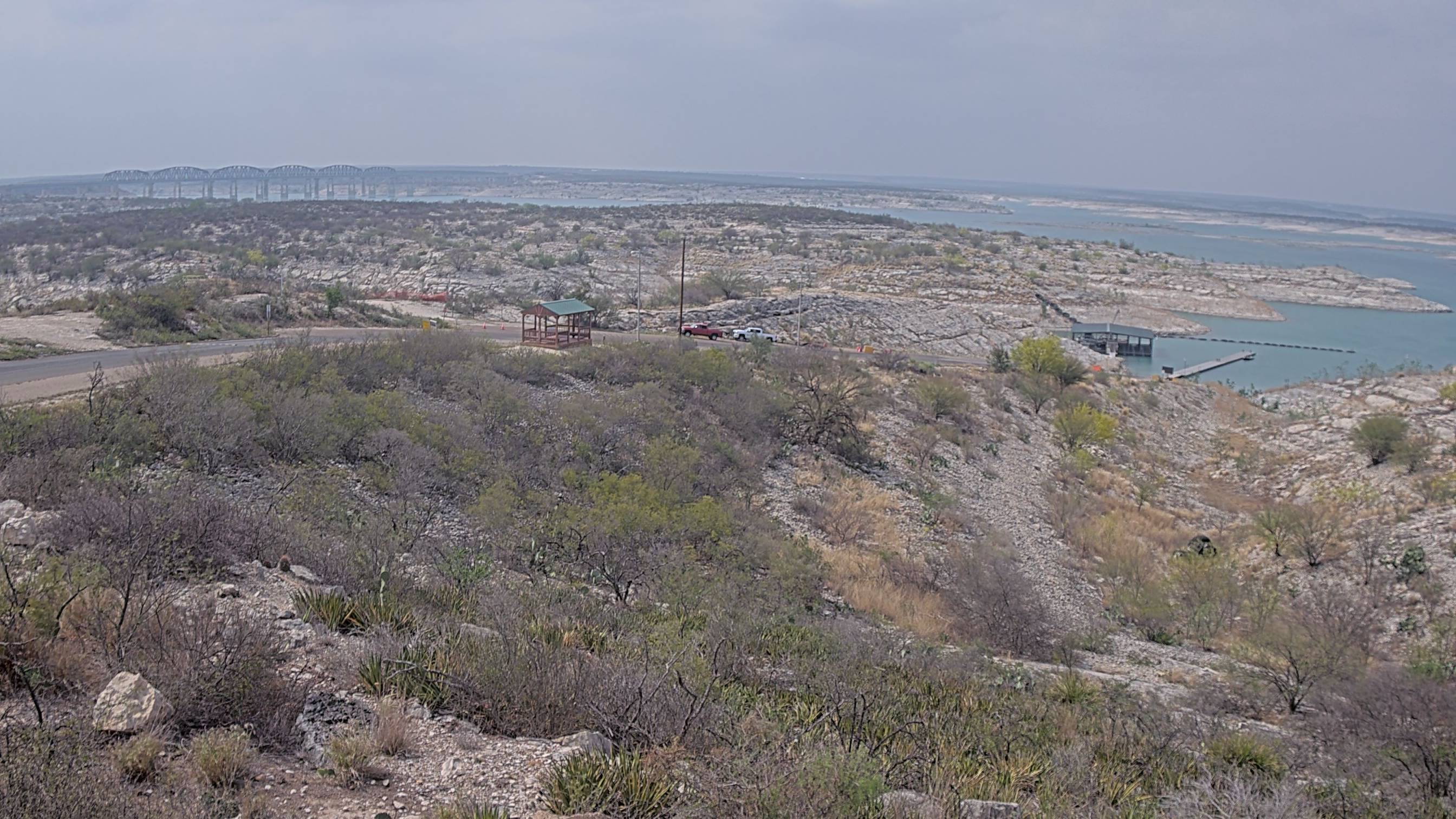
The Big Bend National Park Webcam provides a sweeping view across the Chihuahuan Desert from the Panther Junction area. Located near park headquarters at an elevation of approximately 3,750 feet, the camera looks north over desert grassland and mountain ranges extending far beyond the park.
Lone Mountain dominates the right side of the view, approximately 1.3 miles from the camera. More distant landmarks include Rosillos Peak, Santiago Peak, Elephant Mountain, Cathedral Mountain and Nine Point Mesa. Some of these features stand more than 50 miles away, and exceptionally clear conditions can reveal mountains over 80 miles from Panther Junction.
This is also Big Bend’s air-quality and visibility camera. It is especially useful for checking haze, cloud cover, approaching storms and the clarity of long-distance views. On a clear day, individual ridges appear sharply defined. When dust, smoke, humidity or regional air pollution reduces visibility, the distant mountains may fade or disappear completely.
The camera is not a continuous video stream. It captures an updated still image approximately every 15 minutes during daylight hours.
Watch Weather and Visibility at Panther Junction
Because the camera looks across such a vast landscape, changing atmospheric conditions become part of the view. Summer thunderstorms can build dramatically over the mountains, while rain may bring a temporary flush of green to the desert. Winter cold fronts can produce unusually crisp visibility and occasional snow on higher terrain.
The foreground also shows the characteristic vegetation of the northern Chihuahuan Desert, including creosote, yucca, sotol, grasses and several species of cactus. The landscape may appear sparse from a distance, but it supports a remarkably diverse desert ecosystem.
About Big Bend National Park
Big Bend National Park protects more than 800,000 acres of mountains, desert and river country in far West Texas. Its southern boundary follows the great bend of the Rio Grande, which separates the United States from Mexico and gives the park its name.
Three landscapes define Big Bend. The Chihuahuan Desert covers most of the park, the Rio Grande cuts through enormous limestone canyons, and the Chisos Mountains rise like an island from the desert. The Chisos are the only mountain range located entirely within a United States national park.
This combination of desert lowlands, river habitat and high-elevation woodland supports extraordinary biological diversity. More than 450 bird species have been recorded in the park—more than in any other national park in the country. Black bears live in the Chisos Mountains, while javelinas, mule deer, coyotes, roadrunners and numerous reptiles inhabit the surrounding desert.
The park’s elevation ranges from approximately 1,800 feet along the Rio Grande to 7,825 feet on Emory Peak. That difference produces substantial variations in weather. A summer afternoon that is dangerously hot beside the river can be noticeably cooler in the Chisos Mountains.
Panther Junction occupies a central location near the northern foot of the Chisos. Park headquarters, the main visitor center and an important junction of park roads are located here. Although the webcam faces away from the Chisos, its north-facing panorama demonstrates just how far the Big Bend landscape extends beyond the park’s most famous mountains and canyons.
See Texas Parks Webcams

How Far Can You See from Panther Junction?
Long-distance visibility is the defining feature of this webcam. Lone Mountain stands closest to the camera and provides a useful reference point when judging atmospheric clarity. Rosillos Peak lies approximately 15 miles away, Santiago Peak about 37 miles away, and Elephant and Cathedral mountains more than 50 miles from Panther Junction.
On clear days, the distant ridges retain their shape, color and separation. Under hazy conditions, the same ranges blend into the sky or vanish. Visibility is generally clearest during winter, while summer often brings more haze as prevailing winds transport moisture and airborne pollutants into the region.
Big Bend can experience remarkable clarity, but its remote location does not isolate it from pollution. Sulfates, smoke and fine particles can travel long distances before reaching the park. The webcam therefore serves both visitors checking the view and scientists documenting changes in one of Big Bend’s most important scenic resources.
Planning a Visit to Big Bend National Park
Big Bend is extremely remote, and distances within the park are substantial. Panther Junction is centrally located, but reaching Santa Elena Canyon, Rio Grande Village, Castolon or the Chisos Basin requires additional driving. Visitors should arrive with adequate fuel, water and time.
Late fall through early spring generally provides the most comfortable conditions for desert hiking. Summer heat can be life-threatening, particularly at lower elevations and near the Rio Grande. Afternoon thunderstorms are most common during the summer rainy season and may cause flash flooding.
Terlingua is the best-known western gateway community. Marathon provides access from the north, while Alpine is the region’s largest service center. Lodging and campsites can fill during the cooler months, so overnight plans should be made before beginning the long drive into the park.
Why Use the Big Bend National Park Webcam?
- See current conditions at Panther Junction.
- Check long-distance visibility across the Chihuahuan Desert.
- Watch clouds and thunderstorms develop over the mountains.
- Compare clear and hazy conditions.
- See Lone Mountain and several distant West Texas ranges.
- Observe seasonal changes in desert vegetation.
- Look for winter snow on distant higher terrain.
- Preview conditions before traveling into this remote park.
Big Bend National Park Webcam FAQs
Where is the Big Bend webcam located?
The camera is in the Panther Junction area near Big Bend National Park headquarters and the park’s primary visitor center.
What does the webcam show?
The camera shows Chihuahuan Desert vegetation, Lone Mountain and several distant mountain ranges north of Panther Junction.
What direction does the camera face?
The current NPS air-quality camera record identifies the view as looking north. An older park description calls it northwest, but the present landmark guide supports the north-facing designation.
Which mountains are visible?
Identified landmarks include Lone Mountain, Rosillos Peak, Santiago Peak, Elephant Mountain, Cathedral Mountain and Nine Point Mesa. Visibility determines how many can be seen at one time.
Is the Big Bend webcam live?
It is not continuous streaming video. The camera captures a current daylight image approximately every 15 minutes.
How far can you see?
On exceptionally clear days, mountain features more than 80 miles away may be visible. Haze, dust, smoke, clouds and humidity can substantially shorten that distance.
Is the webcam located in the Chisos Basin?
No. It is located at Panther Junction, east of the road leading into the Chisos Basin. The camera faces north, away from the central Chisos Mountains.
What is the best time to watch the webcam?
Morning and late afternoon often produce the most textured light across the desert. Winter frequently brings the clearest long-distance visibility, while summer offers the best chance of seeing dramatic thunderstorm development.
What is the best time to visit Big Bend?
Late fall, winter and early spring generally offer the most comfortable temperatures. Summer can be dangerously hot, especially in the desert lowlands and along the Rio Grande.
More Texas Webcams
See More of Texas!
For more live views from the region, explore our Texas Webcams, Texas Lake Webcams, and National Park Webcams.